
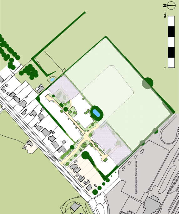
Station Rd, Quainton, Aylesbury
The Brief
RIDA Reports Ltd was appointed to conduct a detailed flood risk assessment for a proposed residential development located at Station Rd, Quainton, Aylesbury. The project involves the construction of six new dwellings on a greenfield site of approximately 2,840 square metres. The assessment was required to determine the site’s vulnerability to current and future flooding, ensuring the ‘More vulnerable’ development could be safely established without increasing flood risk elsewhere.
Why the Client Chose RIDA
The client required specialist technical expertise to navigate the National Planning Policy Framework (NPPF) and local Buckinghamshire Council requirements for a new multi-dwelling residential project. RIDA was selected for its proven ability to deliver robust flood risk compliance strategies, provide practical mitigation advice, and supply the essential documentation necessary to support a smooth planning application process.
The Challenge
While the site is situated within Environment Agency Flood Zone 1, representing a low risk of fluvial or tidal flooding, the assessment identified specific local constraints. Surface water mapping indicated a low risk of overland flows, but highlighted a residual risk of localised shallow ponding with potential depths of up to 0.3 metres affecting specific plots on the site. Conversely, the risk of groundwater and sewer flooding was deemed very low. Additionally, transitioning from a greenfield to a developed site required a careful approach to surface water management to prevent increased runoff, and the site’s location outside of the Environment Agency’s Flood Alert service area necessitated standalone safety planning.
The RIDA Difference
RIDA conducted a detailed flood risk assessment evaluating all potential flooding sources, strictly adhering to NPPF guidelines and the Local Flood Risk Management Strategy. To directly mitigate the identified surface water ponding risk, RIDA recommended that the finished floor levels for the most susceptible plots (Plots 1, 2, and 3) be raised to 86.5m AOD, safely above the existing 86.2m AOD ground level and the 0.3m potential water depth. To address the greenfield transition, we outlined a Sustainable Drainage Systems (SuDS) hierarchy to safely accommodate and attenuate surface water run-off, replicating the natural drainage regime. Furthermore, to overcome the lack of an active flood warning service, RIDA prescribed a site-specific Flood Management and Evacuation Plan, establishing a clear, safe egress route via Station Road that remains viable during extreme events.
The Outcome
The assessment successfully demonstrated that, subject to the proposed mitigation measures, the site can be developed in full compliance with the provisions of the NPPF and the requirements of the Environment Agency and the local planning authority. By integrating raised floor levels, flood resilience interventions, and a SuDS-led drainage strategy, the report provided clear evidence that the development will remain safe over its 50 to 100-year design life without increasing flood risk to the surrounding area.