

According to a 2024 official report,6.3 million properties in England are at risk of flooding. This is expected to get worse with climate change, as EA projections suggest one in four properties could be residing in a flood-prone area. Unlike short-term flood risk, long-term flood risk looks at the chances of flooding over an extended period of time from all sources, such as rivers, sea, and surface waters.
It is important to check the long-term flood risk in your area. This helps in decision-making about insurance, buying property, developing your site and avoiding natural disasters. This blog will include how to use official tools, including government websites and long term flood maps, to check for long term flood risk and what preventive measures you can take to protect your family and home.
What is Long Term Flood Risk?
A flood is an overflow of water in normally dry land. It can be caused by heavy rainfall, snowmelt, or storm surges and may result in damage and loss of life. Flood risks are divided into two main categories: long term flood risk and short term flood risk. Long term flood risks predict the chances of flooding over the years or decades, taking climate change into account. Unlike short-term flood risk, it does not include immediate warnings.
It is important to check long term flood risk; homeowners can consider it when buying a property or for an insurance policy. For example, if an area has a high risk of long-term flood (3.3 annual chances), homeowners should consider insurance and protection measures. Developers and planners use long-term flood risks to make informed decisions and require flood risk assessments
How to Check Long-Term Flood Risk
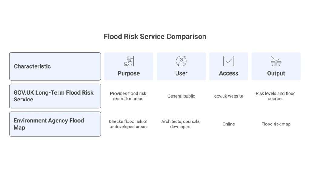
The UK Government provides official tools to check the long term risk of your area. Let’s go through them one by one.
GOV.UK Long-Term Flood Risk Service
This is an official service provided in England, called the long term flood risk service, available on the gov.uk website. You have to simply enter the postal code or the name of your area. The tool provides a report that includes risk levels and flood source categories.
Steps:
- Visit the gov.uk Long-Term Flood Risk Service.
- Enter your postal code or the area’s name.
- The report will show risk levels and sources, such as Rivers and the coast.
Surface water, Reservoirs, and Groundwater. - The report will also label each risk with its intensity (Very Low, Low, Medium, or High)
Checking the UK flood risk by postcode is the quickest and easiest way. It is also easier to understand and more helpful for local residents.
Environment Agency Flood Map for Planning
This is another tool provided by uk.gov to check the flood risk of undeveloped areas. It is used by architects, local councils, and developers. Basically, anyone planning to use a land, area, or plot for development..
This map is easily accessible online, and you can search by:
- Postcode
- Place name
- National Grid Reference (NGR)
- Easting and northing coordinates
Or you can simply explore the map manually.
This map gives information about :
- Flood risk assessment requirement
- Different flood zones(1,2,3)
You can also request detailed flood risk data from the Environment Agency and even print the map. People applying for planning permission also use this map.
How to Interpret the Long-Term Flood Map
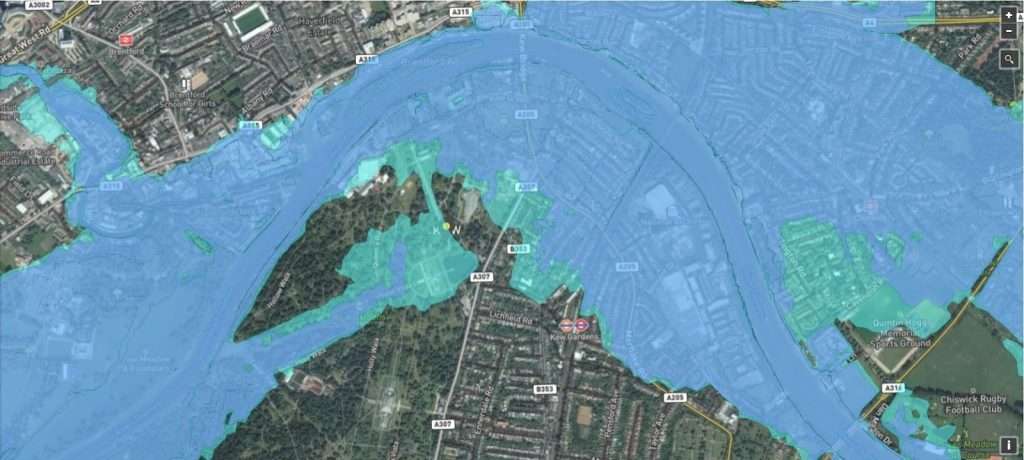
Once you open the long-term flood map report, it is important to understand the layout of the map to understand it. The long-term flood risk map includes flood risk sources and risk levels.
Flood risk levels are defined by an annual probability of a flood. For example, in a high Risk area (3.3% chance per year), the likelihood of experiencing at least one flood over 25 years is about 57%. For Medium Risk areas (1–3% per year), the 25-year probability ranges from 22% to 53%, while Low Risk areas (0.1–1% per year) present a 2.5% to 22% chance. Even Very Low Risk areas still carry around a 1–2% chance of flooding over 25 years.
The flood risk level is also broken down by sources: rivers/coast vs surface water vs reservoirs. Many inland areas have a higher surface water flooding risk as compared to river risk. Same way, if you are living near a reservoir, the map can show “reservoir flooding” in case a dam fails.
Consider a medium or a high risk as a warning sign and take appropriate measures. Assess your flood insurance or think about a professional flood risk assessment. Additionally, long-term flood maps also provide you with a future climate scenario to take proactive long-term measures.