Why understanding your flood risk is critical today
Knowing the level of flood danger in your location is crucial if you’re wondering, ”Is my property in a flood risk area”? In England, flooding has an impact on insurance, property safety, planning permissions, and resale value for homeowners, buyers, landlords, and developers.
The Environment Agency estimates that 6.3 million properties in England are at risk from rivers, the sea, or surface water ,and that number is expected to increase to 8 million properties by the middle of the century as a result of climate change (Environment Agency 2025). Using official tools and expert assistance is crucial whether you are determining if the house is in a flood risk area, checking the risk of flooding in the neighborhood, or evaluating flood risk for planning purposes. Rida reports provide expert flood risk assessments and drainage strategies to help homeowners, property buyers, and developers understand and manage local flood risks in line with planning regulations.
Establishing the baseline: What is the risk of flooding in my area?
Examining official maps from the environment agency is the first step towards comprehending the risk of floods in my neighborhood. Planning authorities utilize these maps, which display long-term flood risk, to assess development applications.
Key reasons to use environment agency mapping:
- Identify if your property is in a flood risk area
- Check what the flood risk in your area is
- Understand exposure from rivers, the sea, surface water, and groundwater
- Include climate change projections for future risk
Flood defenses reduce risk but do not remove it completely. Even protected areas retain residual risk.
The essential tool for homeowners and buyers: Check the long term flood risk for an area in England
The primary public resource for determining whether your home is in a flood risk region is the Environment Agency’s:
Check the long-term flood risk for an area in England. This service provides a long term overview of flood risk in your area, rather than short-term weather warnings:
What does this service show?
By entering your postcode, you can see flood risk from:
- Rivers and the sea
- Surface water
- Reservoir flooding
- Groundwater flooding
The map also includes information on how climate change increases flood risk over time, which is particularly important if you are buying a property or planning long-term development.
Important limitations:
This service
- Does not forecast floods at the level of a single property
- Excludes the dangers of burst pipes and clogged drains
- Does not take the place of a flood risk assessment
RIDA reports create expert flood risk assessment based on local ground levels, flood paths, and drainage conditions when site-specific information is needed, especially for planning. Don’t forget to check out our flood risk maps.
Using the flood map for planning: flood risk for planning applications
It is insufficient to simply assess the flood risk in your area if you are developing. The flood map for planning is used in England to make planning decisions.

What the flood map for planning is used for
This service allows you to
- Verify if a flood risk assessment is necessary
- Determine the site’s flood zone
- Get flood maps that are ready for planning
- Support planning and environmental checks
You can search using :
- Your postcode
- A place name
- A national grid reference
When a flood risk assessment is usually required
You will normally need a flood risk assessment if:
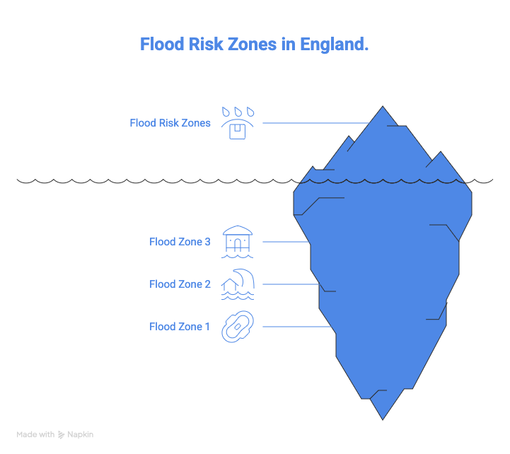
- Development is suggested in either flood zone 2 or flood zone 3
- The area of the site exceeds one hectare
- There is a potential for surface water flooding
- Development may make other areas more vulnerable to flooding.
Understanding the different ways your house can flood
To fully answer “Is your property in a flood risk area?”, you need to understand the different courses of flooding.
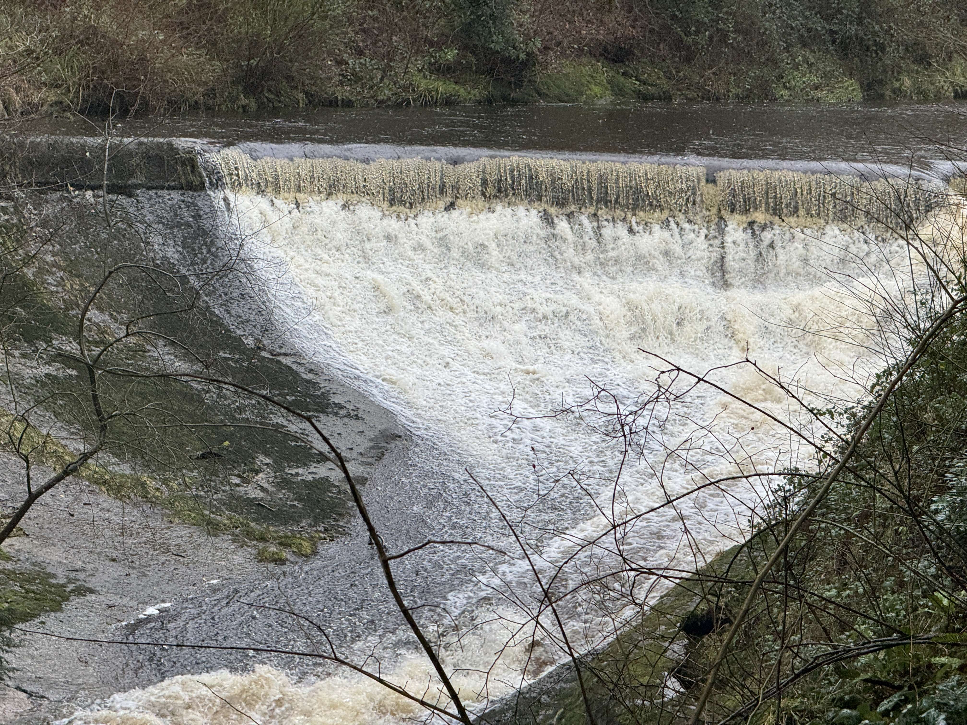
River and coastal flooding
When rivers overflow following extended or intense rainfall, river flooding takes place. Rising sea levels and storm surges are the main causes of coastal flooding.
Key points:
The Environment Agency is in charge of
- The sea level in the vicinity of England is rising by about 4 mm annually
- Rivers and the water pose a threat to almost 2.7 million dwellings
- Both the long-term flood risk map and the planning flood map display these hazards.
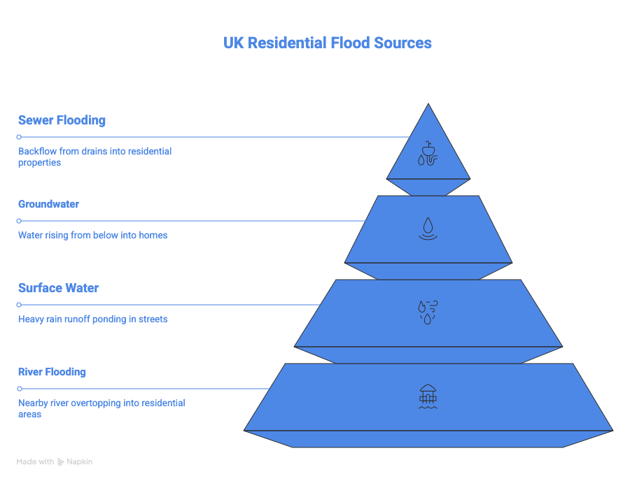
Surface water flooding
Surface water flooding occurs when rainfall cannot drain away fast enough. It often happens:
- Away from rivers
- During intense rainfall events
- In urban areas with hard surfaces
Surface water flooding is now the most widespread flood risk in England.
Current data reveals:
- Surface water flooding poses a threat to about 4.5million properties
- Many of the impacted properties had never experienced flooding
- Surface water flood risk is managed by the lead local flood authorities, usually country or unitary councils.
Groundwater and sewer flooding
Groundwater flooding happens when the water table rises after prolonged rainfall, often affecting basements and low-lying areas.
Sewer flooding occurs when:
- Public sewers are overloaded
- Blockages restrict flow
- Heavy rainfall exceeds system capacity
Sewer flooding is managed by water and sewerage companies. This type of risk is not fully mapped nationally, which means professional investigation is often required for planning and property assessments.
Who is responsible for managing flood risk in your area?
Responsible authority | Role |
Environment agency | Rivers, the sea, and national oversight |
Lead local flood authority | Surface water and groundwater |
Water and sewerage companies | Public sewers and drainage |
Highway authority | Road gullies and drainage |
Property owners | Private drainage and internal flooding |
If a watercourse runs through or alongside your land, you are considered a property owner and are responsible for its maintenance.
Managing immediate danger: Look for flood services:
The Environment Agency offers the check for flooding service for short-term or imminent flood risk.
This service allows you to:
- Check the most recent flood alerts by postcode.
- See the chance of flooding during the next five days
- Register for notifications via the flood warning service.
Flood warning levels explained
1)Flood alert- Flooding is possible
2)Flood warning-Flooding is expected
3)Severe flood warning- severe flooding expected; danger to life
Although this service is essential for safety, it should always be used in conjunction with planning assessments and long-term flood risk assessments
What should you do if your house is in a flood risk area?
If you find that your property is in a flood risk area, early preparation can significantly reduce damage.
Steps to take:
- Make an emergency contact list and a flood strategy.
- Have a flood kit on hand
- Put in place flood prevention measures for your property.
- Move cars and valuables to a higher location.
- Steer clear of driving or walking in floodwater.
- If an evacuation is necessary, turn off the utilities.
Conclusion
In England, the risk of flooding is rising. Understanding flood risk in your location is essential to responsible property ownership and development, as 6.3 million properties are presently at danger and climate change is predicted to considerably increase this number.
Next steps:
- Use official maps from the Environment Agency to assess the long term risk of flooding
- Prior to submitting applications, use the flood map for planning
- If you are purchasing, creating, or submitting a planning application, hire RIDA reports to conduct a comprehensive flood risk assessment.
- Sign up for flood alerts to stay informed and prepared.
By acting immediately, you can safeguard your property, assist with planning approval, and guarantee that flood risk is securely handled going forward.