UK flood areas are prone to flooding from rivers, the sea and heavy rainfall. These flood areas have been identified by official authorities, such as the EA flood map for England, and there are strict development policies for these areas. A flood risk assessment is often required to support development in higher risk locations.
Recently, the UK has seen a rise in storms and flood warnings/alerts due to climate change. Research states that around 6.3 million properties are at risk of flooding in the UK, and this number is predicted to rise in the mid-century.
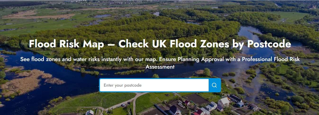
Use our map to see your flood zone, check your flood risk from all sources, see 5 day weather forecast and future flood risk based on climate change on our flood map by RIDA Reports.
All you have to do is:
- Go to our website.
- Add your postcode.
You will find information about:
- Your present and future flood risk.
- Flood risk from sea, rivers, surface water and reservoirs.
- Access historic maps.
- Flood defences in your area.
- Areas with flood warnings
In this guide, we will list down areas in the UK at risk of flooding, what tools you can use to identify them and how to protect your property if you are in a high-risk flood zone.
Areas Most at Risk of Flooding in the UK
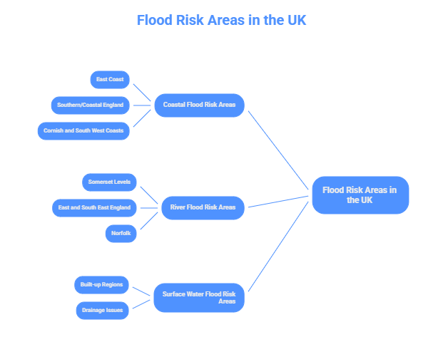
Coastal Flood Risk Areas
Coastal areas, areas closer to coastlines, estuaries (where rivers meet the sea), and seaside areas are at high risk of flooding. If we talk about England, the east coast ( North Sea) faces the risk of storm surges and sea level rise. For instance, a tidal storm can push the Humber and East Anglian estuaries, which will directly put Hull, Great Yarmouth and Norfolk at risk.
Southern/coastal England has similar flood-prone areas. The south east, such as Kent and Sussex face flood risk from the coast and rivers. For instance, 20% of commercial buildings in Sussex and Kent lie in flood-prone areas.
The Cornish and South West coasts can also flood from Atlantic storms. Thames Bridge was built after the 1953 flood for protection against floods. In simple terms, coastal areas of the UK face flood threats and can flood because of high tides and storm surges that can overwhelm the defences.
River Flood Risk Areas
The low-lying areas of England along major rivers face the highest risk of inland flooding. The Somerset Levels are vulnerable to river flooding because most of the land lies below sea level, which means the rivers and sea defences can easily overflow and affect the land.
The East and South East England also face the same flood risk from rivers; for instance, counties like Essex have tidal rivers that rise during North Sea storms. This has already caused the flood of 1953. About today,14% of properties in Essex face river flood risk.
Similarly, Norfolk is flat with many rivers and broads. Historical flooding has cut off towns such as Norwich in this zone. In general, river flooding occurs when prolonged rain or tidal surges cause the river to overflow and exceed its capacity.
Surface Water Flood Risk Areas
The built-up regions UK face surface water flood risk; basically, the drains can be overwhelmed due to heavy rainfall and water pools up in dry land. As a matter of fact, surface water flood risk is the most widespread flood threat; in England alone, 4.6 million properties are at risk of surface water flooding, exceeding the numbers for river and seawater flooding( 2.7 million).
Flood Maps to Identify UK Flood Areas
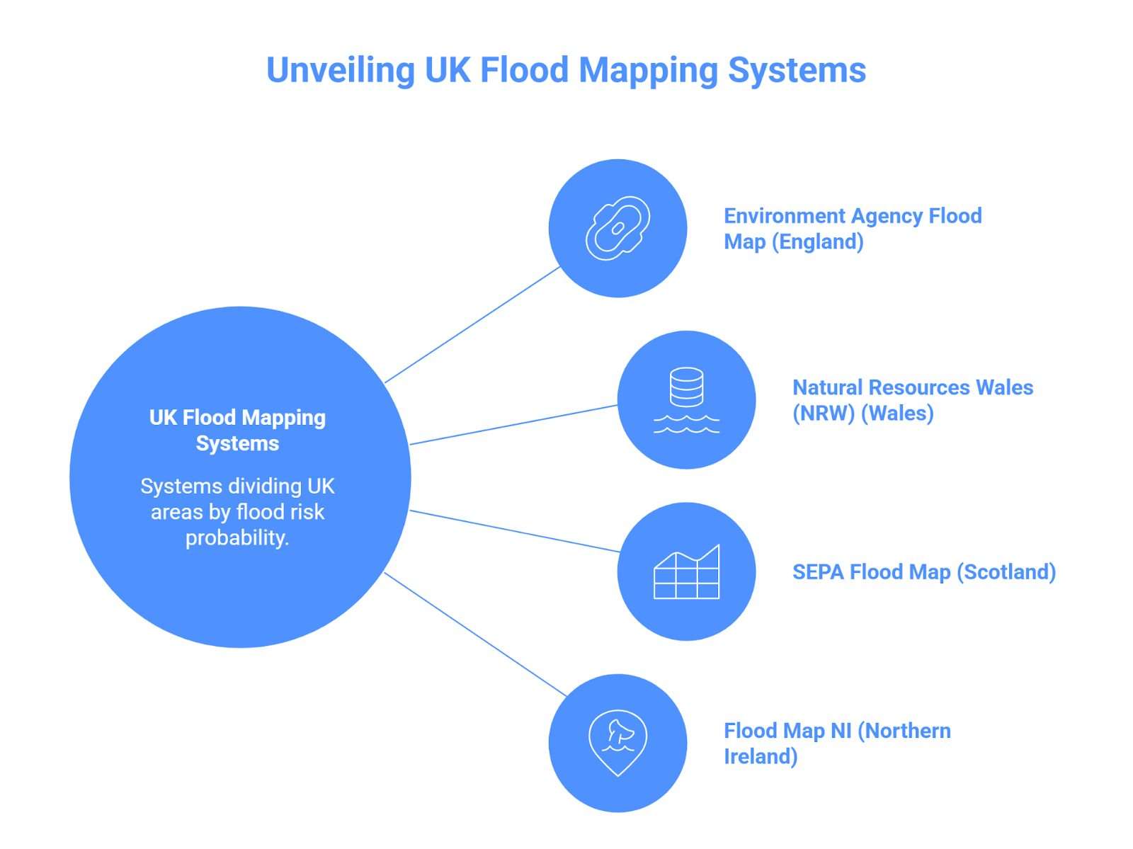
Fortunantely UK has a flood mapping system that divides an area based on flood risk. You can also check long-term flood risk and current flood risks. The only thing you need to keep in mind is Engalnd, Scotland, and Wales have their own separate flood mapping and flood checking tools.
We are going to list down different tools and also mention which UK country they belong to.
Environment Agency Flood Map
The Environment Agency in England provides a primary flood map tool known as “ flood map for planning’. This flood map has divided the area of England into three flood zones based on flood risk probability from the sea and rivers.
This tool is a go-to solution to find flood areas in England. Let us look at the flood zone description of the flood map for planning in detail:
- Flood Zone 1: This zone has the lowest risk of flooding and is the clear zone on the map. This zone has a <0.1% annual chance of river/sea flooding (less than 1-in-1,000).
- Flood Zone 2: Flood zone 2 faces a medium risk of flooding, and housing developments are allowed only after a successful flood risk assessment. This zone has a 0.1–1% annual chance (1-in-100 to 1-in-1,000) of river flooding and 0.1–0.5% of sea flooding. The light blue area of the map is part of flood zone 2.
- Flood Zone 3: This zone has the highest risk of flooding, and housing development is generally not allowed. This zone has ≥1% annual chance from rivers or ≥0.5% from the sea. Please note this zone is divided into flood zone A and B, with flood zone 3 B facing a≥3.3% chance (1-in-30).
How to Check Flood Areas Outside England?
Wales, Scotland and Northern Ireland also have their own flood mapping systems; in short, the entire UK has flood map systems to guide and protect everyone.
- Wales: Natural Resources Wales (NRW) is responsible for flood mapping and managing flood risk. Wales has its own flood map for planning, which is equivalent to England’s flood map for planning.
- Scotland: The SEPA Flood Map shows flood risk from rivers, the sea, and surface water. The Scottish Enviroment Portection Agency is the flood risk authority of Scotland.
- Northern Ireland: Flood map NI is an interactive flood map for Northern Ireland that shows areas at flood risk.
Eventhough UK faces flood risk from multiple sources, the government and official authorities have a robust system to predict, protect and prevent it.
Am I at Risk of Flooding?
There is no direct yes or no answer to this question. For you to check your flood risk, you need to consult flood checkers and flood maps provided by the UK government. For instance, you can add your postcode and check for flood in gov.uk website.
There are multiple tools available to assess your flood risk, in addition to the flood maps we have already mentioned:
One thing you need to keep in mind about these flood checking tools is that they provide area-wise information and not building-specific information. Your building might be fully protected from flood, and you can still be situated in flood zone 2 or 3.
If you want to check for flooding specifically for your building, you can opt for a flood risk assessment. RIDA reports perform flood risk assessment in 48 hours, and we check all flood sources, use flood modelling 1 and 2, run all possible floor scenarios and create successful mitigation strategies.
What to Do If You’re in a UK High Flood Risk Area
- First thing First Do not panic! If you are in a high flood risk zone, just stay calm, learn the official advice and prepare a plan. Subscribe to Enviroment Agency flood alerts and during alert periods, monitor the EA’s “ Check for flooding” service, and you can also use floodline( 0345 988 1188 (24/7) ) for guidance.
- The next step should be property-level measures. Assess your property and go for flood resilience material, like flood barriers, non-return valves, etc.
- Hire RIDA Reports for professional flood risk assessment to understand which sources can bring flood to your property, what the annual chance of flooding and how to mitigate the flood risks.
- Perform a drainage assessment, install a sustainable drainage system for extra protection, as it is advised by the Environment Agency. We provide the installation of SuDS in 5 days!
- Last but not least, ensure good flood insurance. There is a government-backed scheme called Flood Re that provides affordable insurance to homes in high-risk flood areas.
A flood warning should not put you in panic, remember the UK has a robust flood risk management system, and it is always possible to prevent bad circumstances with safety steps!