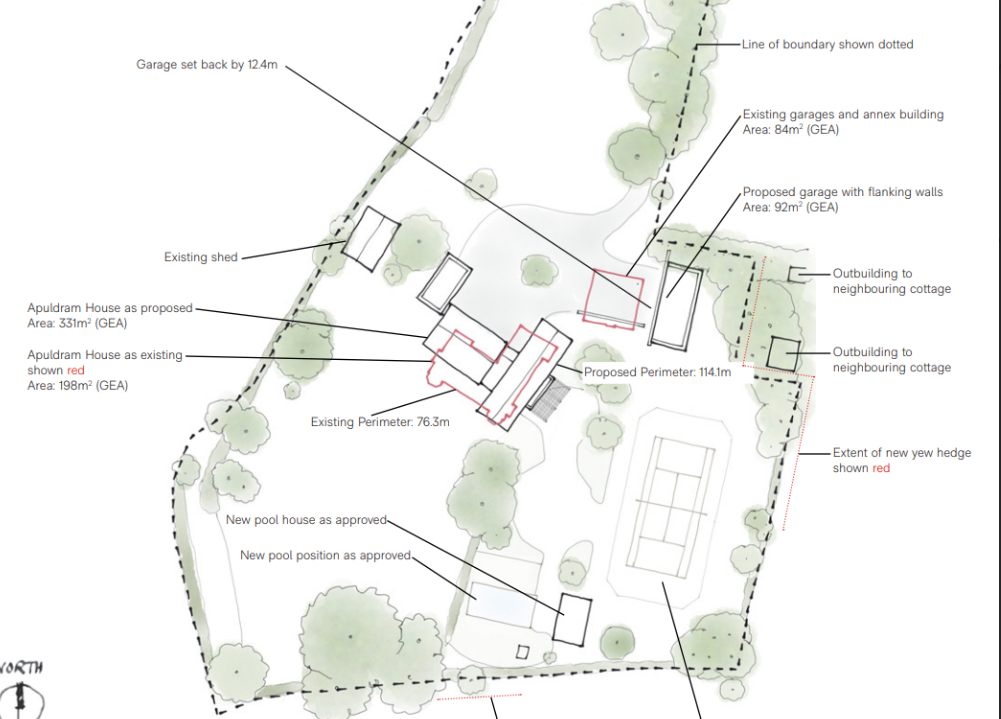
Apuldram House, Dell Quay Road
The Brief
RIDA Reports was appointed to undertake a detailed flood risk assessment for a proposed residential redevelopment at Apuldram House, located on Dell Quay Road in Chichester. The project involves the demolition of an existing country house and its surrounding outbuildings, to be replaced by a newly constructed principal dwelling, garage, pool, and external buildings. Spanning an area of approximately 10,000 square metres, the scale of the site required a comprehensive evaluation to ensure the new structures would remain safe and sustainable over their estimated 50 to 100-year lifetime.
Why the Client Chose RIDA
Because the proposed development area exceeds one hectare, a site-specific flood risk assessment was a mandatory requirement to support the planning application. The client engaged RIDA for our established expertise in navigating national and local flood risk compliance. They required a consultancy that could accurately identify site-specific constraints and provide practical, compliant mitigation strategies to satisfy the requirements of the Local Planning Authority and the Environment Agency.
The Challenge
The primary environmental constraint identified during the assessment was a medium risk of groundwater flooding, with the potential for groundwater to emerge above the ground surface due to seasonal variations and local geological conditions. While the development footprint itself is situated within Flood Zone 1—indicating a very low risk of fluvial or tidal flooding—the site is located just 50 metres from the Fishbourne Channel, with adjacent coastal areas falling into higher-risk Flood Zones 2 and 3. Additionally, planning policy dictated that the development must not increase the risk of surface water flooding elsewhere, requiring careful management of site drainage and runoff.
The RIDA Difference
We conducted a detailed flood risk assessment in strict accordance with the National Planning Policy Framework (NPPF), applying a sequential risk-based approach which confirmed the ‘More Vulnerable’ residential development was appropriate for the site without the need for an Exception Test. To directly address the identified medium risk of groundwater flooding, we developed targeted mitigation strategies. We specified raising the ground floor threshold levels a minimum of 150mm above ground level to provide a safe freeboard allowance. Furthermore, we recommended the installation of a tanking membrane up to 200mm above ground level and the design of dedicated flow paths around the development to safely direct any emerging groundwater away from the structures. To address surface water constraints, we outlined a strategy utilising the SuDS hierarchy to ensure the post-development runoff rate would not exceed existing levels.
The Outcome
The assessment successfully demonstrated that the site’s flood risks could be actively and safely managed through our specified design interventions. By clearly detailing how the groundwater risks would be mitigated and how surface water would be sustainably attenuated, the report established full compliance with the NPPF and the Local Flood Risk Management Strategy. Ultimately, the comprehensive assessment provided the robust technical evidence required to support the client’s planning application.