
94 Walton Rd Molesey East Molesey
The Brief
RIDA was appointed by the property owner to conduct a detailed flood risk assessment for a proposed development at 94 Walton Road, East Molesey. The project involves the change of use of an existing building from a social club to a place of worship. As the proposals do not include any alterations to the internal layout or external fabric of the building, the assessment focused on the suitability of the new use within the existing site context.
Why the Client Chose RIDA
The client required specialist expertise to navigate National Planning Policy Framework (NPPF) guidelines for a site situated within an area of known flood risk. They engaged RIDA to provide a comprehensive and robust assessment that would satisfy the Environment Agency and the local planning authority, demonstrating that the proposed change of use could be achieved safely and compliantly.
The Challenge
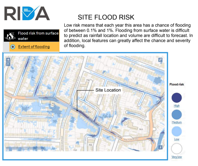
The primary constraint for the site was its location within Environment Agency Flood Zone 2, indicating a medium probability of fluvial flooding from the nearby River Ember. While the risk of surface water and groundwater flooding was identified as low, the assessment noted historical records of sewer flooding in the surrounding area. Furthermore, the site is positioned within an established Environment Agency Flood Warning Area and falls within a potential reservoir dam breach flooding path, necessitating careful consideration of emergency procedures and safe egress.
The RIDA Difference
RIDA conducted a detailed flood risk assessment, evaluating the site against NPPF criteria to determine the compatibility of the proposed use. By classifying the new place of worship as a ‘Less vulnerable’ development, RIDA established that the change of use was entirely appropriate for Flood Zone 2.
To address the identified risks, RIDA linked specific mitigation strategies to the site’s constraints. To mitigate the risk of sewer flooding, the assessment recommended the installation of non-return valves on all new connections to the sewer network. To manage the residual fluvial and reservoir breach risks, RIDA outlined a clear Flood Management and Evacuation Plan. This included advising occupants to register for the Environment Agency’s Flood Alert service and identifying a safe egress route via Spencer Road towards Candle Mews, which is situated safely beyond the extent of potential flooding.
The Outcome
The detailed flood risk assessment successfully demonstrated that the proposed change of use is fully compatible with its flood zone location and complies completely with NPPF guidelines. By integrating pragmatic mitigation measures and a clear emergency evacuation strategy, the report confirmed that the development will remain safe for its design life and will not increase flood risk elsewhere, providing vital support for the planning application.