- Fastest in the UK: Flood Risk Assessments in 48 Hours • Drainage Strategies in 5 Days.
Years Of Experience
0 +
We provide costs effective River models for your needs
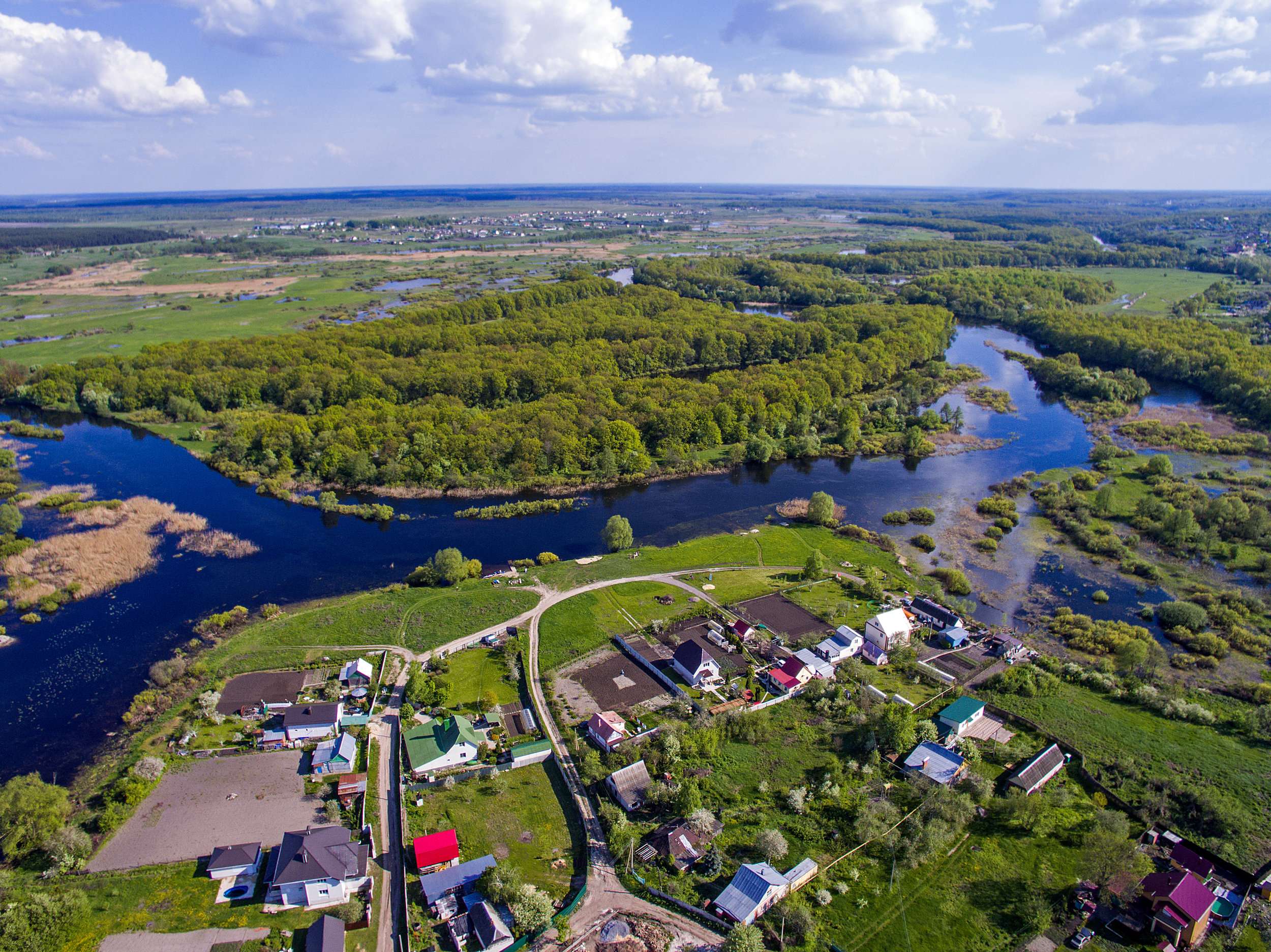
Our team has substantial experience in create 1D and 2D river models that enhance the Environment Agency’s flood data and provides reliable information on for your development or protection of your assets.
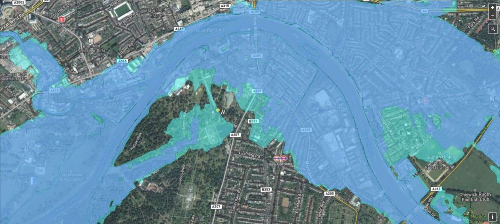
Our models create a representation of the flood zones to clearly quantify the extent, velocity and depth of flood and our experience provides clear guidance on the resilience and resistance interventions that your development can undertake.
Our river modelling helps you when you are looking at:
- Creating a development within the flood zone which has not been modelled by the Environment Agency
- Building a flood protection wall or bund around your property or asset
- Determining the final floor levels of properties to protect them against flooding
- Improving the surface network such as pipe and ditches to create a more resilient developments
- Determining the climate change impact on your development or asset
- Creating safe access and egress routes
- Installing critical assess that require failure impact assessments
Our Flood River Models
We combine the flood risk expertise with our flood data to give you a more accurate assessment flood levels and characteristics. Give us a call, we are happy to talk you through the options.
1D river modelling
1D river models represent the flow along the watercourse. 1D river modelling is used when:
- The river has a channel as a similar cross section along the area of study
- The flood zone has the same shape along the cross section
- Substantial area of rivers are culverted or channelised
- There is an obstruction that cause the flow to back-up for example culverts, bridges and weirs.
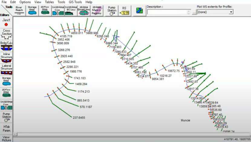
2D river modelling
2D river models allow for the complete representation of the flow regime within the flood plain. It contains the ground surface including its elevation with x, y and z coordinates. The river modelling principles:
- Flow hydrographs derived from the FEH hydrological study
- It is based on digital terrain models (DTM). DTM excludes trees, vegetation and buildings while these are included within DSM data
- Combines 1D within the model
- Provides a complete understanding of the flood zone and its interaction with the river channel
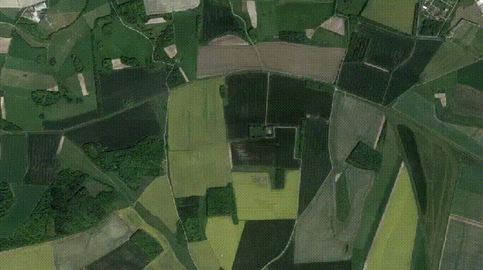
In general 1D river models only are use in conjunction with 2D models to provide a more reliable representation of the flood zone as it is unlikely that the flood zone has constant shape along the channel. A combination of these two type of models are use to determine the flow regime within the flood plain for flood risk assessment.
What you expect from us
- Fixed fee for our work
- Excellent communication with the environment Agency
- Complete walk over surveys of watercourse
- Plan, organise and supervise topographical surveys
- Fully complaint model to the Environment Agency standards
Advantages of using our river modelling expertise
- Increasing the accuracy of the flood extent, levels, velocity and their impact to your development
- Creating a more resilient development by providing clearly understanding the duration, flow paths and hazard of the flood event within the development
- Providing a better rational to management of flood risk within the catchment
- Helping to highlight the development sustainability and safety over its lifetime
- Providing greater support for sequential and exception tests
- Allowing to fully integrate Sustainable Drainage Structures within the flood zone and its impact on flooding
- Providing detailed velocity and flood depth information that inform evacuation plans
- Ensuring that the access and egress routes within the evacuation plans remain safe in the event of a flood.
What Our Customer Says
James Cogley Cogley Structural Solutions
We have had the pleasure of working with Arge at RIDA over several years and throughout this time the experience has consistently been very good. What stands out most is their responsiveness - any queries or issues have always been addressed promptly, which has given us great confidence and peace of mind.
Jon Lipka M&E Design and Build Ltd