
Flood Risk Assessment South Oxfordshire
Our Flood Risk Assessments in South Oxfordshire ensure that new developments meet planning policies for flood risk


Flood Risk Assessment Across South Oxfordshire
We support flood risk assessment projects across South Oxfordshire, covering a range of towns and locations with varying planning requirements and flood risk considerations. Our experience working across different site conditions and local authorities allows us to provide clear, tailored advice for each site.
Our work includes projects across:
- Didcot, Wallingford and Cholsey
- Benson, Goring and surrounding areas
- Thame, Wheatley and Chinnor
- Henley-on-Thames and Sonning Common
- Watlington and surrounding villages
Flood Risk Assessment South Oxfordshire
Flood risk assessment costs in South Oxfordshire depend on the size, location and complexity of your site. Find some of our prices below.
Flood Risk Appraisal
Any size development
Details site potential within the floodplain before making an investment decision or starting your master plan design
Flood Risk Assessment – Extensions and Change of Use
Developments less than 250 square metres within flood zone 2 or 3
Flood Risk Assessment – Single Dwelling
Developments less than 1,000 square metres within flood zone 2 or 3
Flood Risk Assessment – Minor Development
Developments less than 2500 square metres within flood zone 2 or 3
Learn more about flood risk assessment cost and what factors influence pricing across different development types.
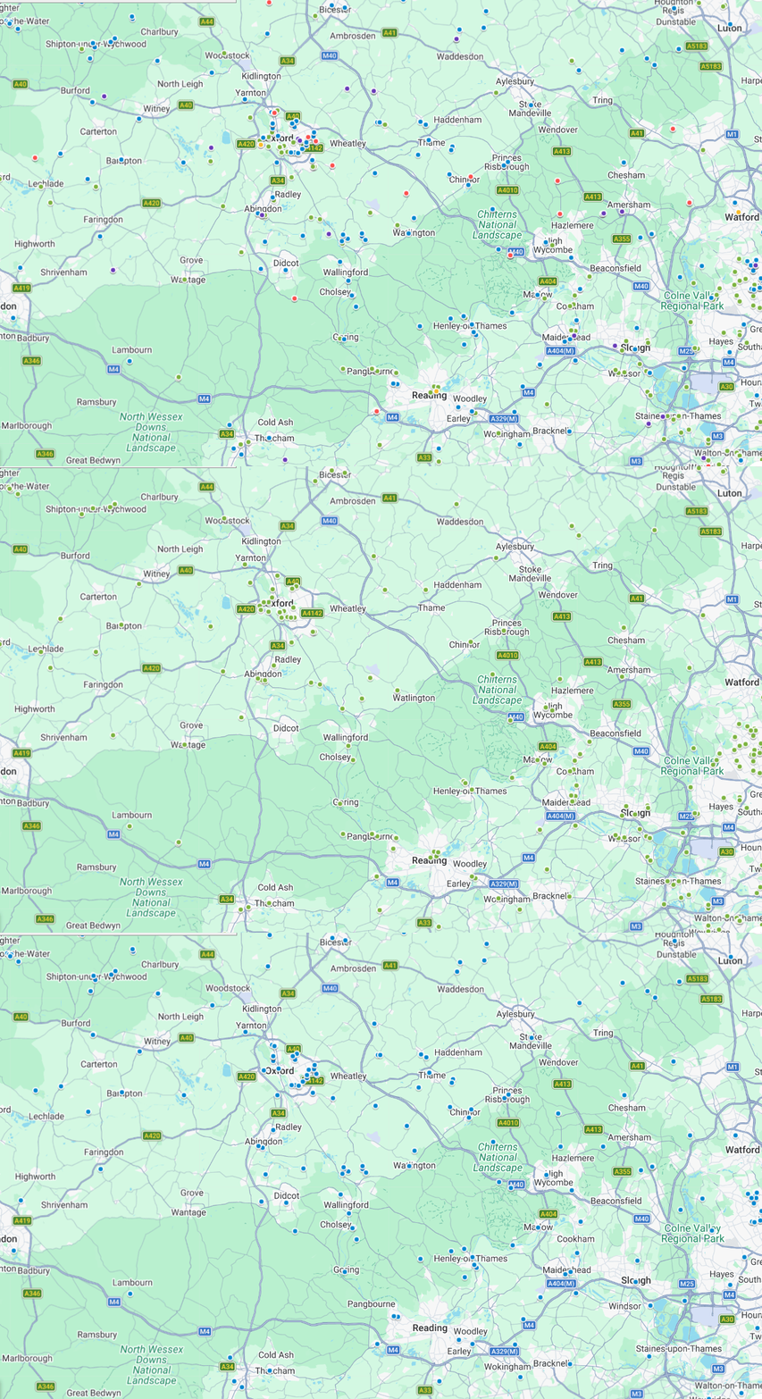
RIDA's Reports Flood Risk Assessments Projects
in South Oxfordshire
With experience in South Oxfordshire’s more flood-prone locations, we know how to handle complex sites and support planning applications across all flood zones.
Our Projects
Our Clients






Our Clients
What Our Customer Says
Steve Morley
MDA Wirral Ltd
We have a long association with RIDA, this is due to their high standards of professionalism and detailed level of information provided. Always efficient, responsive and reliable working with tight deadlines, highly recommended.
James Cogley
Cogley Structural Solutions
We have had the pleasure of working with Arge at RIDA over several years and throughout this time the experience has consistently been very good. What stands out most is their responsiveness – any queries or issues have always been addressed promptly, which has given us great confidence and peace of mind.
Jon Lipka
M&E Design and Build Ltd
I had an excellent experience with RIDA. From start to finish, their team was professional, responsive, and genuinely committed to customer satisfaction. Communication was clear and consistent, and they went above and beyond to make sure everything was done right on site at Soho Farmhouse.
Understanding Flood Risk in South Oxfordshire
Flood risk assessment in South Oxfordshire reflects its position within the Thames Valley, influenced by the River Thames and a network of tributaries that shape flood risk across the district.
Flooding varies by location, with fluvial risk affecting areas close to rivers, while surface water flooding is also a key consideration in towns and along transport routes during periods of heavy rainfall. Environment Agency mapping, local flood data and the use of sustainable drainage systems (SuDS) help identify how different flood mechanisms interact with development across the area.
When do you need a Flood Risk Assessment in South Oxfordshire?
In South Oxfordshire, a Flood Risk Assessment may be required where flood risk needs to be addressed clearly as part of planning applications and demonstrate that the proposal can be made safe. The requirement can arise from flood zone mapping, large site thresholds or proposals that introduce a more vulnerable development type.
Common scenarios include:
- Development in Flood Zones 2 or 3: If your site is within Flood Zone 2 or Flood Zone 3, an FRA is usually required as part of the planning submission.
- Sites over a certain size: Sites in South Oxfordshire that are 1 hectare (10,000m²) or larger can still require an FRA even in flood zone 1.
- Change of use: A change of use to residential accommodation may trigger the need for an FRA where vulnerability increases.
- Basement extensions: Basement works can require an FRA to demonstrate safe access, resilience and appropriate mitigation.
Stop flood risk from delaying your plans. Get a clear, approval-ready flood risk assessment NOW!
Flood Risk Assessment Consultants South Oxfordshire
Flood risk assessment consultants in South Oxfordshire provide practical, site-specific advice to support planning applications, feasibility studies and development projects across the District.
Planning-Ready Flood Risk Assessments
Our team of enginners prepare detailed Flood Risk Assessment Reports that clearly identify and manage flood risk within a proposed development project or site based upon the requirements of local planners.
Flood Risk Analysis & Mitigation
We assess all types of flooding, (surface water, river, groundwater) associated with the potential flood risk at each site. We include clear, practical recommendations to help manage flood risk effectively.
South Oxfordshire Expertise & Local Experience
With experience working across sites in Didcot, Wallingford, Thame and Henley-on-Thames, we understand the flood risks specific to South Oxfordshire, from river-related constraints to surface water and groundwater consideration
What is included in a planning-ready Flood Risk Assessment in South Oxfordshire?
- Flood risk classification relevant to the site location
- Review of mapped flood data and planning constraints
- Assessment of vulnerability and development compatibility
- Outline mitigation principles where required
- Clear planning-focused conclusions and recommendations
- Identification of key flood risk considerations for planning submission
Benefits of our Flood Risk Assessments in South Oxfordshire
Flood risk assessments provide a detailed analysis of all potential flood sources, offering tailored mitigation strategies for your development in South Oxfordshire. You’ll receive clear, specific and expert report which:
Meets the local and national planning policies
Costs effective in the mitigation of flood risk
Enables you to make informed changes to the design and achieve planning
Safeguard your development from flooding throughout its lifetime
Who we help with our Flood Risk Assessments in South Oxfordshire
Our approach focuses on clear, decision-ready content, keeping reports concise while fully supporting the reasoning. In South Oxfordshire, we aim to produce reports that are easy to reference during planning discussions.
Typical clients:
- Homeowners in South Oxfordshire who want a clear report that supports their planning applications without overcomplicating the submission.
- Architects working in South Oxfordshire who need an assessment that follows the drawings and reinforces the scheme narrative for planning permission.
- Planning consultants coordinating technical inputs in South Oxfordshire who value clear scope boundaries and easy-to-reference sections.
- Developers in South Oxfordshire seeking professional reports that integrate cleanly across multidisciplinary teams.
Local Planning Context for Flood Risk in South Oxfordshire
Across South Oxfordshire, flood risk is a key planning consideration, particularly for developments near the River Thames (Henley-on-Thames, Wallingford) and tributaries such as the River Thame, as well as smaller watercourses across the district.
For planning applications, a Flood Risk Assessment in South Oxfordshire should consider both Environment Agency flood zone mapping and local drainage requirements, demonstrating that flood risk has been properly assessed in line with national policy and local guidance.
Key guidance and local resources include:
Secure your Flood Risk Assessment today and avoid costly planning setbacks
FAQS
A Flood Risk Assessment is generally required if your site is located within Flood Zone 2 or Flood Zone 3, or if the proposed development exceeds one-hectare in size and is in Flood Zone 1. South Oxfordshire District Council, may also require that an FRA is prepared based upon known surface water or drainage problems.
The South Oxfordshire Strategic Flood Risk Assessment (SFRA) is a document created to assists planners in making decisions regarding planning applications and can help identify whether a site specific Flood Risk Assessment would be necessary prior to granting permission.
Yes, flood risk can be assessed through postcodes via online Government resources available. However, please note that these resources are limited to providing general data. Therefore, a site specific Flood Risk Assessment is often required for planning applications in South Oxfordshire to accurately assess flood risk and secure approval. We have also created a tool to search your property by postcode, which you can access here.
Flooding in South Oxfordshire includes flood from rivers (Thames) as well as flood from surface water into built up areas; also some parts of the Chiltern area have flood risk through groundwater due to the underlying geology.
The level of risk will depend upon the specific location at which you are located in relation to your development project.
Depending upon the scale, the location of your proposed development and its complexity a Flood Risk Assessment could take anywhere from a few days for smaller residential schemes to weeks or longer for larger developments with greater risks associated with them.
At RIDA Reports, we offer a 48-hour turnaround for many projects where the required site data is readily available.