Flooding Near Me: How To Stay Informed And Protect Your Property
Flooding near me: How to stay informed and protect your property
Searches for flooding near me have increased significantly as communities across the UK face more frequent and unpredictable extreme weather events. From sudden surface water flooding after intense rainfall to river and coastal flooding during prolonged storms, the impacts are becoming harder to ignore. Whether you are a homeowner, tenant, buyer, or professional involved in planning or development, knowing how to quickly identify local flood risks using a Flood Risk Map is essential for protecting property, ensuring personal safety, and making informed decisions.
The United Kingdom is becoming more concerned about flooding as a result of intense weather and shifting rainfall patterns. Understanding how to track flood risks, decipher official alerts, and locate impacted locations is essential for planning and safety for locals, prospective homeowners, and professionals.
Checking for floods, interpreting warnings, and getting ready for possible flood events are covered in this guide. For more detailed, property-specific insights, professional flood risk assessments from RIDA Reports can help homeowners and developers understand both immediate and long-term flood exposure.
Flood checks and monitoring local flooding
To evaluate both short-term and long-term threats, a flood check is crucial. To monitor local flooding,the UK government and other agencies offer tools and services.
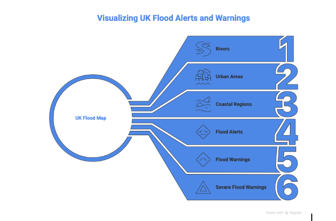
The UK government’s ‘check for flooding’ service provides live updates across England, Scotland, and Wales, including:
Flood alerts-the area may experience flooding
Flood warnings-flooding is anticipated; prompt action is advised
Severe flood warnings-life-threatening; immediate evacuation may be required
Similar services are offered by regional organisations like Natural Resources Wales and SEPA(Scotland), guaranteeing that locals have access to current information.
Real-time mapping
Interactive flood maps highlight:
Areas currently affected by floods
Active flood warnings and alerts
Major rivers and high-risk watercourses
These maps allow property owners and commuters to assess risk and plan travel routes safely. RIDA Reports also offers interactive flood maps that provide postcode-level risk information, helping property owners make informed decisions about mitigation, insurance, and planning.
Alert registration
By signing up for alerts, you can receive direct email or SMS updates. Property managers, homeowners, and experts in charge of at-risk locations may find these notifications especially helpful as they contain practical advice.
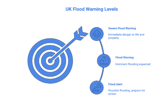
UK flood warning levels and response
The UK uses a three-tier flood warning system, providing clear guidance on actions required:
Warning level
Meaning
Action
Example
Flood alert
Be prepared
Move valuables to higher ground: monitor updates
Minor flooding in gardens or low-lying streets
Flood warning
Take action
Protect property: consider temporary evacuation
River overflow affecting property access
Severe flood warning
Danger to life
Evacuate immediately: follow emergency guidance
Properties evacuated due to severe river or surface water flooding
Flood zone 3b (Functional Flood Plain) has become bigger. The 1 in 30 storm event is now applicable instead of the 1 in 20.
The functional floodplain (Flood Zone 3b) has been altered. The previous requirement of an annual probability of 1 in 20 (5%) or greater has been updated to 1 in 30 (3.3%) or greater. As a result of this change, a larger portion of land is likely to be considered a functional floodplain, and it is typically not deemed suitable for development unless the flood risk vulnerability classification is water-compatible.
Sustainable Drainage Systems are required for all developments and are a must for sites within the flood zone or at risk of any type of flooding.
Multifunctional Sustainable Drainage Systems (SuDS) are to be applied to all development affected by flooding. This includes surface water flooding. SuDS are now expected to be standard in new developments. However, an emphasis has been placed on utilising above-ground multifunctional SuDS, which provide benefits for biodiversity, amenities, and water quality, in addition to their traditional role of managing water quantity. Moreover, the use of SuDS is required in order to pass the sequential test of your development.
This system ensures residents and businesses understand the level of risk and the appropriate measures to take.
Roads and travel disruptions: Effects on transportation
Travel interruptions and safety risks are often caused by flooded roads caused by heavy rainfall.
Infrastructure impact: Flooded roadways can cause traffic jams and postpone heavy rainfall.
Urban areas: Cities like London and Birmingham, which have high impermeable surfaces and poor drainage, are particularly at risk.
Guidelines for driving safety:
Steer clear of floodwater when driving
Observe local government directives and official detours
Use news sources and real-time alerts to stay informed.
Following warnings is crucial since even shallow floodwater can present significant risks.
Property planning and long-term flood risk:
i)Planning for development and property safety depends on an understanding of previous flood data.
ii)Buyers of real estate: Planning, investment and insurance decisions are influenced by historical flood risk.
iii)Planning permission: To satisfy local government requirements and guarantee adherence to drainage and environmental standards, developers must do flood risk assessments.
iv)Historical data analysis: Determining a property’s 1 in 100 year flood risk require slooking beyond the present.
Expert evaluations, like those offered by Rida reports, guarantee that properties are appropriately assessed and suitable mitigating actions are suggested.Using professional assessments alongside government alerts ensures that both immediate safety and long-term property planning are fully informed.
Comprehending MET officer weather alerts
In order to warn communities around the United Kingdom about possible flooding and other weather-related hazards, the MET office issues yellow weather warnings. A yellow warning denotes conditions that could interfere with day-to-day activities, such as restricted property access, travel delays, or localised floods. Businesses and residents are urged to keep an eye on local flood alerts and be ready to take preventative action, such as relocating valuables to higher ground or modifying travel schedules. These alerts are a part of a coordinated strategy that includes emergency services, flood management organisations and municipal authorities, guaranteeing prompt communication and direction to safeguard people and property.
Determining areas affected by flooding in the UK
Today, monitoring flooding in the UK reveals which places are most vulnerable
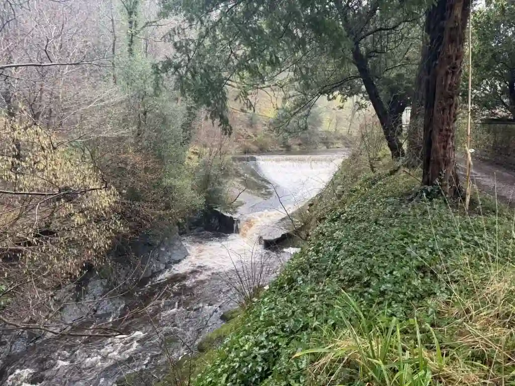
Regional hotspots: Cumbria, Oxfordshire and South Wales have recently experienced flooding.
Flooding types:
Rivers overflowing can result in fluvial(river) flooding.
When excessive rainfall overwhelms drainage systems, surface water flooding happens.
News and local updates: To help individuals understand the risks in their neighbourhoods, councils and media outlets provide real-time updates on affected locations.
Property planning and long-term flood risk
Planning for development and property safety depends on an understanding of previous flood data.
Buyers of real estate: Planning, investment, and insurance decisions are influenced by historical flood risk.
Planning permission: To satisfy local government requirements and guarantee adherence to drainage and environmental standards, developers must do flood risk assessments.
Historical data analysis: Determining a property’s 1 in 100 year flood risk requires looking beyond the present.
Expert evaluations, like those offered by Rida Reports , guarantee that properties are appropriately assessed and suitable mitigating actions are suggested.
Immediate actions during a flood event
Residents and businesses are urged to take prompt, sensible action to save lives and property when flood warnings are issued. In order to reduce risk, family members, pets and valuables should be relocated to higher ground. If flooding is likely, utilities like gas, electricity, and water should be turned off to avoid mishaps and property damage. Communitiesare also urged to assist one another by keeping an eye on vulnerable neighbours, especially the elderly or those with mobility issues, and by heeding advice from emergency services and local authorities. In addition to lowering immediate risks, taking these preemptive steps helps build community resilience, making neighbourhoods better equipped to handle the effects of floods and recover from them faster.
Conclusion
Maintaining awareness of flood hazards is crucial for both property protection and safety. Regular monitoring of official sources, including the MET office and GOV.UK flood services, ensures residents and businesses can respond effectively to flood warnings and changing conditions.
Getting a certified flood risk study is an essential part of planning and protecting assets for real estate developers and buyers. Rida Reports offers thorough evaluations that offer in depth-knowledge of regional flood risks and mitigation techniques.
A yellow weather warning, issued by the MET office, indicates that the weather may cause some disruption or local flooding. While not the most severe level, it signals residents and businesses to monitor conditions, prepare for potential impacts, and check flood alerts.
To see if there are floods near you today, it’s important to check official, real-time flood monitoring services that provide live alerts based on your location. These platforms track river levels, rainfall intensity, coastal conditions, and surface water risks, allowing you to quickly understand whether flooding is occurring or likely to occur in your area.
Official sources provide live flood updates by location
By entering your postcode or selecting your region, you can view current flood warnings, alerts, and areas affected, helping you take timely action and stay informed.Here’s a strong, natural closing line you can add at the end. Checking these official sources regularly, especially during periods of heavy rainfall or storm warnings, ensures you receive the most accurate and up-to-date information to protect yourself, your property, and those around you.
Certain areas are especially vulnerable because of their topography, precipitation patterns or river systems. Cumbria and Lancashire in the northwest, the valleys of South Wales, the coastal and riverine regions of East England, and cities like London where surface water can swiftly build up are all considered high-risk areas.