
Groundwater has become an emerging source of flood, but not many people know enough about it. It is different from river or coastal flooding, since it does not happen all of a sudden and is best understood in the context of a wider flood risk map. Groundwater floods happen when underground water rises and seeps to the surface due to prolonged heavy rainfall.
In this guide, we will explain what is groundwater flood is, how to check your risk using official UK tools and steps to protect your home.
How Is Groundwater Flooding Different from Other Types of Flooding?
Groundwater refers to water held underground in soil or rocks, also sometimes creating a water table. This groundwater rises due to prolonged rain, and at one point, it reaches the surface. Once it reaches the surface, it starts seeping through basements and cells and shapes into a groundwater flood.
Now, this is very different from river or coastal flooding. Let us take a look at the key distinctions of groundwater flood:
- This flooding happens days, weeks or even months after continuous heavy rainfall.
- This flooding can stay for weeks and months
- Water does not enter through doors. Rather, it rises from the ground or floor.
- Groundwater floods can emerge in unexpected places, like hillsides or high ground.
In short, the source is groundwater. Groundwater flooding builds slowly over days and weeks, unlike other types of flooding.
Areas Susceptible to Groundwater Flooding
- Susceptibility is based on local geology, hydrogeology and the ground on which a property is constructed.
- Usually, grounds built with chalk, gravel or sand are more susceptible.
- The British Geological Survey states that many parts of southern and eastern England’s grounds have these permeable materials, making them susceptible.
- Groundwater flooding can happen in different locations, like slopes, plateaus and low-lying basins.
- Weather also adds to the groundwater susceptibility of an area. In England, the grounds in winter tend to store more water, resulting in raised groundwater levels.
Signs of Groundwater Flooding
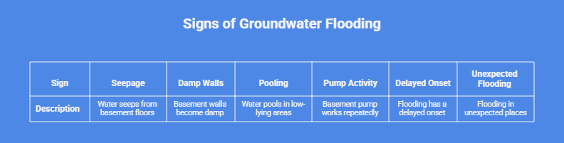
- Water might seep from the basement floors or gaps in the flood slabs.
- The basement walls might appear damp without any signs of a sewage issue.
- If water pools in low-lying areas of the garden and is not getting absorbed by the surface.
- If the basement pump works repeatedly after prolonged rain, then it is most likely pumping the groundwater entering your property.
- Delayed onset of flooding is a sign that it is sourced from groundwater.
- When unexpected places like slopes or hills appear flooded.
Always look for these signs and take immediate action if you observe any of the above signs.
Why There Is No Simple Groundwater Flood Risk Map in the UK
You might expect a groundwater flood map, but it’s quite a complex type of flooding to be mapped. Even the data available in the UK tells about the susceptibility of groundwater flood and not about the probability or predictability.
The only entity that works specifically for groundwater flooding is the British Geological Survey. It provides a susceptibility dataset based on ground conditions.It does not provide probability or depth information
It covers England, Scotland, and Wales, and has a 50 m × 50 m resolution. This map is used for regional planning purposes and not for individual houses. Even the BGS itself warns that it is a coarse dataset, and slight local variations can change how your property is susceptible to groundwater flooding.
For this purpose, if an area is marked “susceptible”, it simply means it has the right geology and groundwater to make flooding possible. It does not mean your property will flood because hazards and risks are not the same thing.
Because of these limitations, an official map for groundwater flood is not available. To check the groundwater flood risk of a specific property, BGS data with past flood records and current groundwater monitoring are required.
Who Is Responsible for Managing Groundwater Flooding in the UK
Though there are no flood maps for groundwater flood, there are official bodies that oversee and handle groundwater flood.
Lead Local Flood Authorities, such as county councils, manage local flood risks, especially groundwater, surface water and ordinary water courses. Their duty is to investigate groundwater flooding under the Flood and Management Act. This investigation is more for recording the event and not fixing it. But the data later on can be used for different flood prevention measures. Strategies
The Environment Agency overall plays a strategic role. It mainly manages flood risk from rivers, the coast and reservoirs. For groundwater, it does not fix local flooding, but provides data and warning signs in areas with a history of groundwater flooding.
Town and District councils enforce planning rules. They make sure new developments include sustainable drainage systems in addition to risk mitigation. As the Government of the UK has made it official that every new development must adopt the SuDS approach.
The British Geological Survey produces scientific data about groundwater that everyone can use when planning. They provide hazard maps and a survey, but no probability information. Their data is often used by developers for flood risk assessments.
Please note that water companies, like Thames Water, handle sewers and the water supply. Homeowners should note that groundwater flooding is generally not a sewer problem.
How to Interpret Groundwater Flooding Information in UK Property Reports
The homebuyer report or environmental reports in the UK often mention groundwater susceptibility. The data in the report is based on a dataset of BGS. It is really important to understand how to interpret it in your home buyer report.
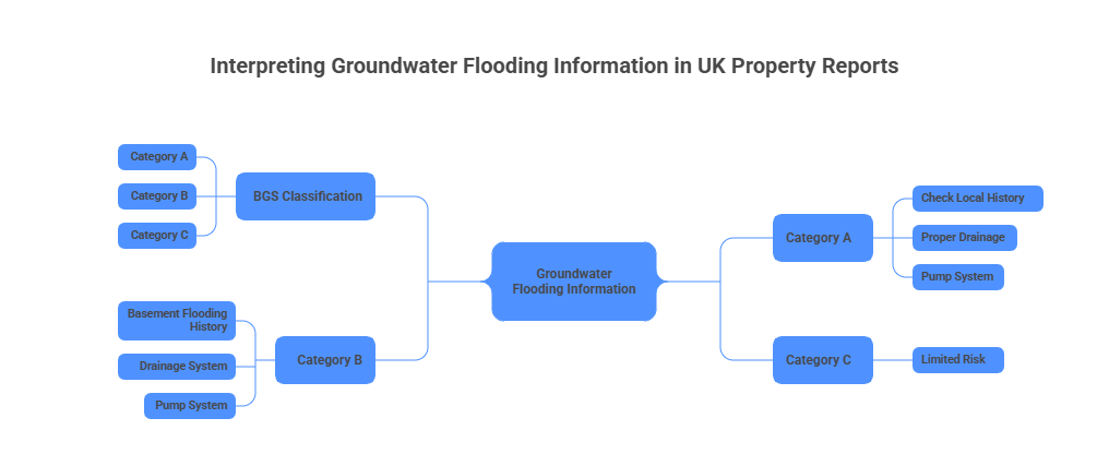
BGS classifies ground conditions into three categories.
- Category A basically means the groundwater can reach the surface. If your report has an “A” in it, it means BGS is advising you to check the local history of your area. Also, make sure your property has proper drainage and a pump system.
- Category B means groundwater flooding will stay below the ground. Here, BGS again advises checking for basement flooding history and making sure the drainage and pump system is available.
- Category C means limited risk —it is less likely for a property in this zone to flood with groundwater.
Please note, these are new and updated definitions by the British Geological Survey, and they may differ from previous sources.
How to Protect Your Property from Rising Groundwater Flood Risk
You can take some protective measures to reduce the risk and prevent damage.
According to the Environment Agency, the most effective protection against groundwater flooding is a sump or a pump system. A basement sump collects groundwater, and a pump pumps it out, also known as a sump-pump assembly.
Lining basement walls with waterproof material also prevents groundwater from seeping out and damaging your walls. Non-return valves can be used to prevent water from re-entering homes.
Things you should avoid are using temporary surface water barriers, like sandbags are not effective in a groundwater flood. Also, avoid digging up soil and changing drainage without professional help. If your property is marked in category A, do not construct a basement and regularly monitor water around the house.
Preparing Your Personal Flood Plan
Finally, make a flood plan for your household now, before any water appears. Key steps include:
Insurance
Confirm your insurance policies cover flooding from groundwater as well as surface water, in addition to river and coastal flooding. Find out if your plans have a “new-for-old” replacement coverage. Always keep a copy of your policy number and insurer contacts in your flood kit.
Flood Kit
Prepare an emergency flood kit, which includes insurance documents, important photos and papers, torches, a battery/hand-crank radio, a first-aid kit, drinking water and non-perishable food, warm clothing, and any prescription medications. Save all documents in a waterproof bag.
Shut Off Utilities
Learn how to turn off gas, electricity and water safely during a flood. This is a vital first response in any kind of flood.
Stay informed
Sign up for flood warnings from official sources like the Enviroment Agency. You can do this via their website or contact them on Floodline. Local adios news is also an authentic source for heavy rain and flash flood warnings
It is always better to plan so you can manage an emergency correctly and calmly.