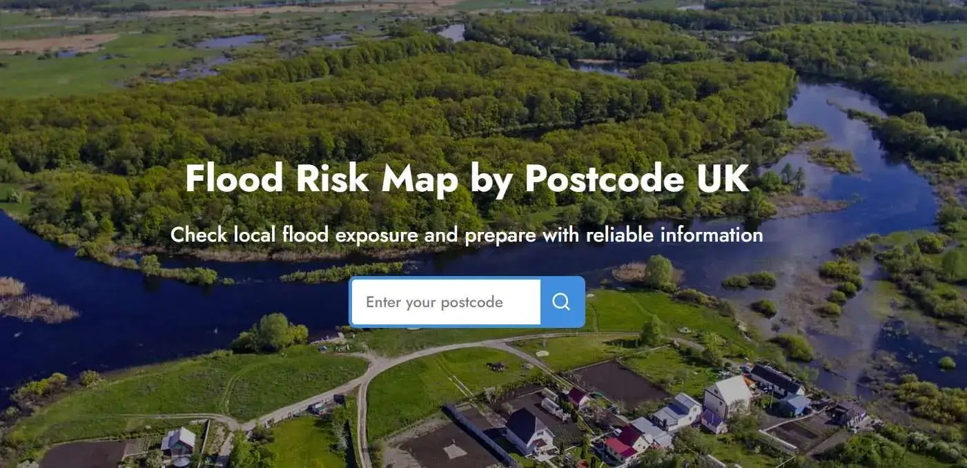
You can use your area’s postcode to check for flood information and access data and updates published by official government and local authorities, including a consolidated flood risk map. The government of the United Kingdom has multiple flood monitoring tools available for different purposes, covering various sources. All you need to do is add your location and obtain the information you are looking for.
These tools include “ check long term flood risk “, “ EA flood maps” and “check for flooding” by the official government and local, yet authentic tools such as the flood map by RIDA Reports. In this guide, we will cover all flood checking tools you can access through postcode in the UK, and guide you on how to use and read them.
Flood Checkers By Postcode

As we stated earlier, there are multiple flood check postcode tools available from the gov.uk and local companies. Let’s take an in-depth look at them.
RIDA Reports Flood Map
RIDA Reports flood map is an interactive tool that uses official datasets from the Enviroment Agency. These tools provide you with information about present and future flood risk. It is easy to use with high-quality data and userfriendly interface.
How to use it
- Go to the RIDA Reports flood map.
- Enter your postcode.
- The flood map and flood risk information for the specific area will open.
- The flood map can be viewed separately for the present and the future.
The map provides:
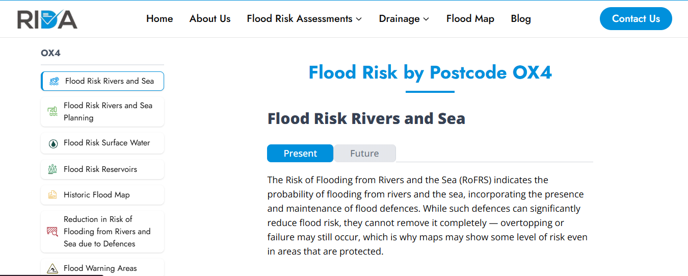
- Flood Zone information.
- Highlights Flood zone 3b separately.
- Flood risks from rivers, the sea, surface water, and reservoirs.
- 5-day weather forecast.
- Historic Flood map.
- Divides the Flood Zones into three distinct colours.
RIDA Reports flood map is an all-in-one tool for planners, developers, architects and homeowners. This map is reliable because its data is based on the Enviroment agency flood data set and flood policies.
Check Long-Term Flood Risk (GOV.UK)
Check long-term flood risk is an online tool available on gov.uk website, which provides flood probability over the coming decades. It accounts for flood sources and climate change for effective information. This service is available in England only; Wales and Scotland have different services.
How to Use it:
- Search “ Check long-term flood risk England” or click here.
- You will be asked to add your postcode
- After the postcode, the page will ask you to select an address
- Once you select your address, the next page about the flood summary will open.
The flood summary will include:
- Flood sources with the highest flood risk
- Yearly flood chance: low, medium or high
- Future yearly flood chance with climate change.
- Surface water flood risk
- Groundwater flood risk
- Reservoir flood risk
This tool clarifies that it tells about flood risk around a building and not for the building itself. For property-specific information, owners can opt for an on-site flood risk assessment.
Check for Flooding in England
Check for flooding is another flood checking tool by gov.uk. This tool allows you to access current flood alerts/warnings, river, sea, groundwater and rainfall levels, weather report and flood risk for the next five days. Again, this tool is for England only.
How to use it:
- Go to “ check for flooding” on gov.uk website or click here.
- You will be asked to enter a town, city or postcode in England.
Once you enter the postcode, you will be able to access the following information:
- Whether there is a flood warning or alert in an area or not.
- Forecast for the next 5 days.
- Long-term flood risk information.
- River, sea, groundwater and rainfall levels by measuring stations.
Checking for flooding is ideal for real-time flood updates, especially if you are located in flood zones 2 or flood zone 3. These tools keep you updated and prepared for any flood-related warning or alert.
Flood Map for Planning
Flood map for planning is an official map by the Environment Agency, and it is available on gov.uk website. This service provides an EA flood zone map, which divides the area of England into three flood zones after studying history, flood models, flood probability and flood sources.
Flood map for planning allows you to:
- Find out if you need a flood risk assessment
- Print the map
- Request additional data
How to use it:
- Open flood map for planning tool.
- You can enter postcode/place/national grid reference (NGR)/easting and northing coordinates.
- Next, you will be asked to select the purpose of using this tool.
- If you select “For planning purposes or scoping a site,” you will be taken to the flood map for planning.
The flood map for planning has:
- a boundary report.
- turn on and off options for different layers, for example, flood zones and the surface water layer at the same time.
- A key will be available to read and understand multiple components of the flood map.
- You will know which zone your area is in, for example, flood zone 2.
- Surface water flood risk.
- Climate change scenarios.
- Water storage, such as reservoirs and water storage areas.
- Flood defences such as walls or embankments
- Main rivers.
Flood map tools are mainly useful for developers, planners and architects. Homeowners can also use them for personal knowledge and preparation before buying a property or beginning a development.
Flood Risk Tools by Region (Wales & Scotland)
Wales and Scotland have their own official flood services, which you can access through postcode.
Wales – Natural Resources Wales (NRW): Wales has two linkedservices to check flood risk: Flood Risk Assessment Wales (FRAW) Map and a postcode search. FRAW is an interactive map that allows you to pan, click anywhere in wales or use the search box. On the other hand,“ Check your flood risk by postcode” only covers welsh post codes.
Scotland – SEPA Flood Maps: The Scottish Environment Protection Agency (SEPA) providesa future flood map service in Scotland. On the SEPA website, you can select or search a location to accessthe flood map.
Understanding Flood Risk Maps and Results
There are a few things you should be clear about to understand the basic purpose of these tools and how to read them. Firstly, these tools express probabilities and no certainties.
Secondly Most maps have four categories for different aspects of the map: very low, low, medium and high. For example, EA/NRW define “High” risk as greater than 3.3% chance per year (about 1-in-30), “Medium” as 1–3.3% (1-in-100 to 1-in-30), “Low” as 0.1–1% (1-in-1000 to 1-in-100) and “Very Low” as below 0.1% (1-in-1000).
Thirdly, these tools predict the probability of a flood; they do not make a statement that “ A flood will surely show up”. For instance, High flood risk does not guarantee a flood; it is a statistical chance representation.
Fourthly, all these tools cover areas and not specific properties. There could be a chance that your property may never flood, but your area of the property might be in flood zone 2, and so you will be considered in a high-risk flood zone.
If you want a site-specific flood risk assessment in 48 hours, contact us at RIDA Reports for a free quote!
Why You Should Conduct a Flood Risk Postcode Check
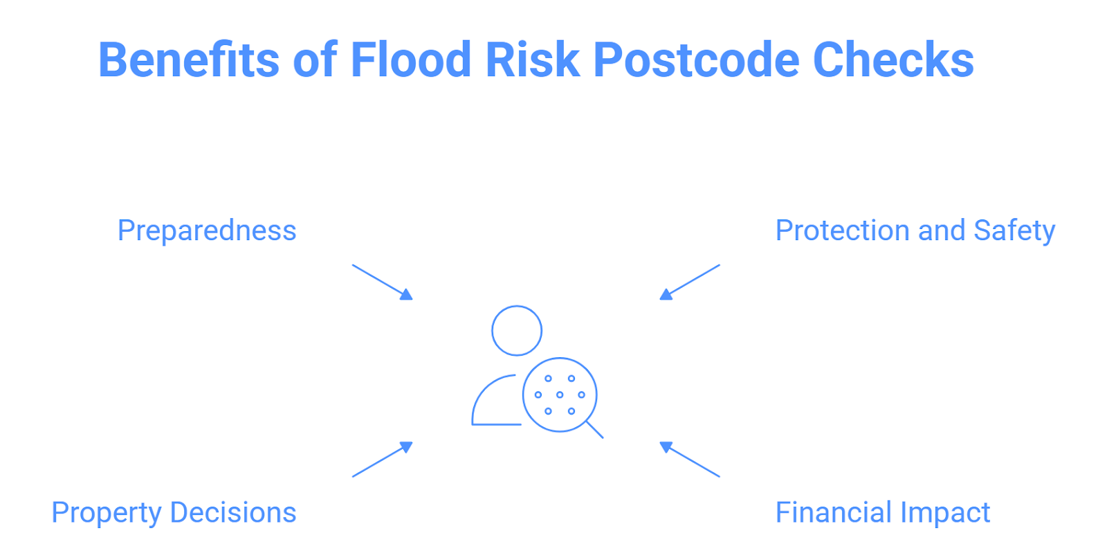
It is important to check for flood risk with the postcode for safety, preparedness, property decisions and financial benefits.
- Protection and Safety: Flood checkers provide information about flood zones, flood probability and flood sources. Checking your flood risk with your postcode can give you information about which flood zone your area is in, which flood sources can affect you and what the annual probability of flood is. This information can guide in taking protective measures.
- Financial Impact: Properties in high-risk flood zones like flood zones 2 and 3 often face expensive insurance and excess by providers. Even though a Flood Re scheme is available to the UK government to make insurance affordable for people, it is only available until 2030. Postcode flood check can also help you understand your insurance expenses and guide you in effective questioning when signing for one.
- Property decisions: If you are planning to develop, sell or buy a property in England, checking your flood risk with the postcode can help you make the right decision. For example, if you want to buy a piece of land, you can use the postcode flood checker to see whether the land is in a low-risk or a high-risk zone, and make the right decision.
- Preparedness: Checking your flood risk with your postcode and knowing about possible storms or flood alerts/warnings in advance can help stay prepared for bad circumstances.