
Flood risk planning is a main part of any development according to the UK planning system. For any development, such as a house or commercial scheme, the applicant must provide evidence that the flood risk has been identified, assessed and managed.
Without this evidence, the local planning authorities in the UK can reject your planning permission application. We have designed this blog as a guide to explain three main pillars for successful flood risk planning in the UK.
The three pillars include:
- Identifying flood risk
- Assessing and testing flood risk
- Designing development to mitigate flood risk.
Identifying Flood Risk Using Maps and Planning Tools
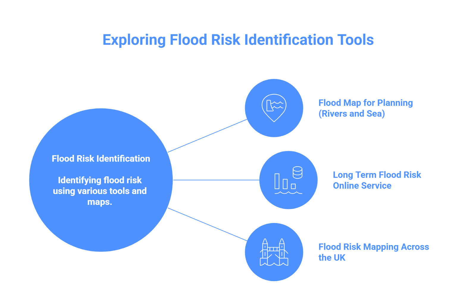
The first step of flood risk planning is to understand how to identify flood risk. To identify flood risk, you can use tools like the Enviroment Agency’s flood map for planning, understanding how flood zones are categorised and used for development planning.
Flood Map for Planning (Rivers and Sea)
The Enviroment Agency in England provides an official flood map for planning. This map divides the area of England into three flood zones based on flood risk. Before we move to details, kindly note that this map only uses rivers and the sea as a source of flooding and does not account for groundwater or surface water.
The flood map for planning categorises the area of England into three flood zones:
Flood zone 1: This is the lowest risk of flood, and unless an area is bigger than 1 hectare, an FRA is not necessary for development. This zone has an annual flood probability of less than 0.1% (1 in 1000) of river or coastal flooding.
Flood Zone 2: This zone carries a medium risk of flooding, basically a probability between 0.1% and 1% (1 in 1000 to 1 in 100) annual chance from rivers, or 0.1% — 0.5% (1 in 1000 to 1 in 200) from the sea. Any kind of development in this zone requires a flood risk assessment.
Flood Zone 3: This zone carries the highest risk of flooding, and normally, housing is not allowed in this zone. It carries a probability of 1% (1 in 100) or greater annual chance from rivers, or 0.5% (1 in 200) or greater from the sea. Any development in this zone requires an FRA.
The map not only identifies the flood risk of your area, but it also tells whether you need a flood risk assessment. Flood risk assessment providers utilise the Flood Map for planning to better study flood risk and design effective mitigation strategies.
Long Term Flood Risk online service (GOV.UK)
For flood risk planning in the UK, knowing river and coastal risk is not enough. Knowing about surface water, groundwater and reservoir flood risk is equally important. The gov.uk provides a “Long term flood risk online service” which tells about the flood risk of an area based on rivers, the sea, surface water, groundwater and reservoirs.
This tool is ideal for understanding all flood risks of an area. Planners can use this to perform a detailed flood risk assessment and make planning permission as smooth as possible. You only have to add your postcode, and this tool will provide all the information needed to know for flood risk planning.
Flood Risk Mapping Across the UK
The EA flood map for planning and checking long-term flood service is only applicable in England. But there are different services available across the UK that can be used to check each flood risk. Fortunately, the broad concept of flood zones and FRAs is the same across the UK; only the terminology and data sources differ.
Wales: Natural Resources Wales provides planning flood zones
Scotland: The Scottish Enviroment Protection Agency maintains its own flood risk map and tools
Northern Ireland: NI Direct provides separate maps.
Assessing and Testing Flood Risk for Planning Applications
Once you have identified your flood risk, whether it is medium or high. The next step is to assess it so you can prepare your flood risk assessment for planning permission. A flood risk assessment is performed for this purpose, and if needed, a sequential and exception test is performed.
What Is a Flood Risk Assessment (FRA)?
A flood risk assessment report is a technical document submitted with the planning application. This assessment is performed to identify all sources of flood risk, determine the likelihood of the site flooding, and explore how this flood risk can be managed.
An FRA is mandatory for any development in zone 2 or 3, and no planning application is accepted without it. A development in zone 1 may also need a flood risk assessment if it covers an area of 1 hectare or more.
Sequential and Exception Tests
Vulnerable constructions like housing and basements in high-risk flood zones 2 and 3 may also need additional testing, like sequential and exception tests.
A sequential test is performed to check if any other alternative, less risky site is available for development. The test proves to the planning authority that no alternative site is available, and development should be allowed in the proposed zone.
Once a site passes sequential testing, it has to go through an exception test. An exception test proves that the proposed high-risk flood site provides sustainability benefits, and it will be designed in a way that provides lifelong protection from floods.
RIDA reports for Flood Risk Planning
We at RIDA Reports provide all services that cover the second pillar of flood risk planning. Our flood risk assessment is done using 1D and 2D flood models and following all guidelines provided by the UK government.
We also provide efficient sequential and exception testing services with our 20+ years of experience in this field. We use official data sources and our engineers’ expertise to help our clients assess and mitigate flood risk.
Designing Developments That Mitigate Flood Risk
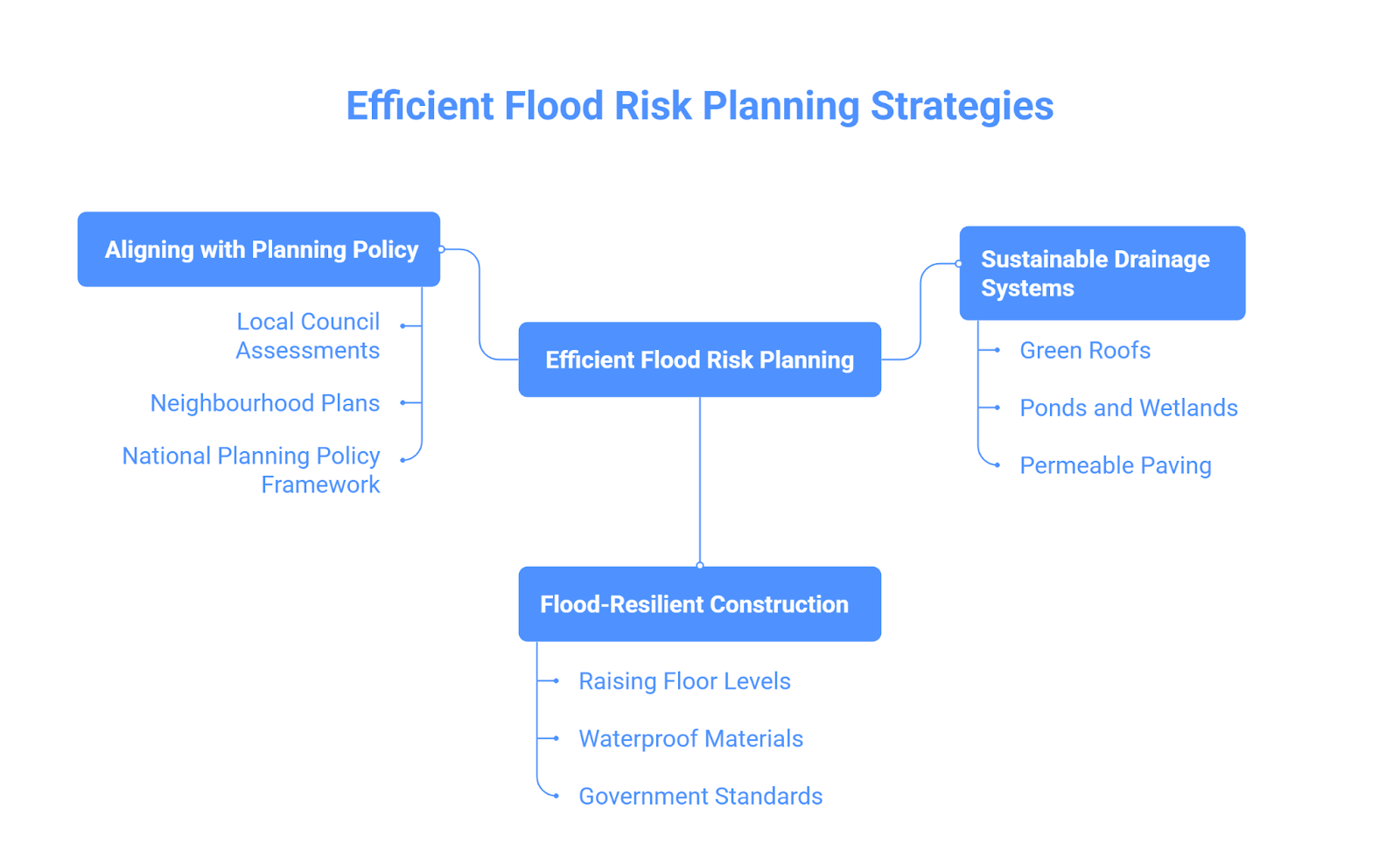
Our last pillar for efficient flood risk planning is design. How we design our development, what material we use and what systems we use to manage surface water.
Sustainable Drainage Systems (SuDS)
Modern policy now mandates sustainable drainage systems for flood risk planning. A sustainable drainage system mimics natural drainage and prevents surface water from sources like heavy rainfall from changing into flooding.
Sustainable drainage systems can take many forms, such as:
- Green roofs
- Ponds or wetlands
- Vegetated swales
- Permeable paving
- Soakaways and infiltration trenches
Flood-Resilient Construction and Materials
In high-risk areas, flood-resilient construction and materials make all the difference. The simplest recommended approach is to raise floor levels, at least 600m above the estimated flood level. Also, to raise the installation of electric sockets, meters and critical installations. Other measures one can take are to use waterproof plasters and non-porous floors.
There are official government standards that exist for protective construction. For instance, the CIRA code of practice provides “property Food Resilience” guidance on materials. And Bortish standard cover guidance on installing and recording from flood resilient measures.
Aligning with Planning Policy
Flood risk planning should always align with local and national policies. For example, Local councils regularly perform strategic flood risk assessments to gain flood risk data that can be used by developers during development and planning permission.
On the other hand, Neighbourhood plans also highlight flood issues, which can assist in designing flood-proof developments. Similarly, the National Planning Policy Framework (NPPF) and associated guidance (Flood Risk and Coastal Change guidance) set rules and regulations on how authorities should work and manage flood risk across the UK. This framework also acts as guidance on where, how and why assessment should be performed. It is always wise to study national and local policies for successful flood risk planning.