
Our Consultants support your Flood Risk Assessment in Kent. We ensure that your development meet planning policies and gets approval

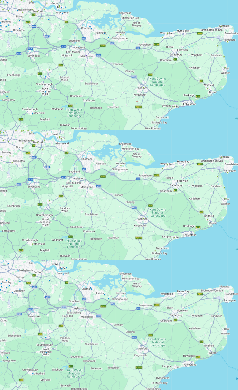
We deliver flood risk assessments for projects across Kent, covering a diverse mix of inland, river and coastal environments. From urban centres to rural and low-lying areas, each location presents distinct planning and flood risk challenges that require a site-specific approach.
Our work includes projects across:
Flood risk assessment costs in Kent vary depending on the size, location and complexity of your site, as well as local planning requirements. Smaller, low-risk developments are typically more cost-effective, while sites in Flood Zones 2 or 3 or with additional constraints may require more detailed assessments and higher fees
Any size development
Details site potential within the floodplain before making an investment decision or starting your master plan design
Developments less than 250 square metres within flood zone 2 or 3
Developments less than 1,000 square metres within flood zone 2 or 3
Developments less than 2500 square metres within flood zone 2 or 3
Learn more about flood risk assessment cost and what factors influence pricing across different development types.
Our experience has enabled us to produce detailed flood risk assessments across Kent, helping to support a broad range of successful planning applications.






Steve Morley
MDA Wirral Ltd
We have a long association with RIDA, this is due to their high standards of professionalism and detailed level of information provided. Always efficient, responsive and reliable working with tight deadlines, highly recommended.
James Cogley
Cogley Structural Solutions
We have had the pleasure of working with Arge at RIDA over several years and throughout this time the experience has consistently been very good. What stands out most is their responsiveness – any queries or issues have always been addressed promptly, which has given us great confidence and peace of mind.
Jon Lipka
M&E Design and Build Ltd
I had an excellent experience with RIDA. From start to finish, their team was professional, responsive, and genuinely committed to customer satisfaction. Communication was clear and consistent, and they went above and beyond to make sure everything was done right on site at Soho Farmhouse.
Flood risk assessment in Kent shows the diversity of its geography (including long coastlines, wide floodplains of rivers and other watercourses) presents varying levels of flood risks across the county. The location of Kent adjacent to the English Channel (which receives tides) means that both fluvial and tidal floods have historically been a threat.
Low lying lands throughout much of Kent are at risk for longer term flooding due to either extended rainfalls or storm surges. Some areas of Kent receive protection from flood defenses. However, surface water flooding is a continuing issue when surface water runoff exceeds local drainage capabilities.
In Kent, an applicant might require to prepare a Flood Risk Assessment as part of the application process. The purpose of this is to indicate how the developer has assessed and will manage the flood risk associated with the proposal. The Assessment demonstrates that the proposed development is safe, does not increase flood risk in other areas and meets the requirements for its specific location.
Common scenarios include:
Planning a project in Kent or along the coast? Find out if a flood risk assessment is required
RIDA Reports is a specialist flood risk assessment consultant, supporting planning applications and development proposals in Kent with reports aligned to Environment Agency datasets, local planning policy and Kent County Council (LLFA) standards.
Planning-Ready Flood Risk Assessments
We produce clear, concise Flood Risk Assessments tailored to support planning applications across Kent, helping demonstrate compliance and reduce delays during the approval process.
Full Flood Risk Analysis & Mitigation
Our reports assess all relevant sources of flood risk, including surface water, river, tidal and groundwater flooding, incorporate up-to-date climate change guidance and set out practical mitigation solutions.
London-Specific Expertise & Delivery
Working throughout Kent, we understand the varying requirements of local authorities and site conditions, from coastal areas to inland developments, ensuring a smooth and efficient planning submission.
Flood risk assessments provide a detailed analysis of all potential flood sources, offering tailored mitigation strategies for your development in Kent. You will receive a clear, well-structured and professionally prepared report which:
Supports compliance with NPPF, PPG and local planning policy
Costs effective in the mitigation of flood risk
Helps reduce planning risk and avoid delays
Support safe and sustainable development over the lifetime of the scheme
Planning reports in relation to flood risk are common throughout Kent when submitting planning application. Therefore, we have developed a model which focuses on clarity, appropriate level of detail and an easy-to-follow format for planners to assess.
Each FRA will provide relevant information relating specifically to the proposed development; drawing from the supporting documents submitted with the development such as plans and statements to avoid duplication of effort.
Typical clients:
In Kent, flood risk is assessed as part of a wider planning and drainage framework, with input from both the Environment Agency (for fluvial/tidal risk) and Kent County Council as LLFA (for surface water and drainage).
Working on a site in Kent? Get clear, planning-ready flood risk advice tailored to your site
Residential flood risk assessments within Kent evaluate flood risk associated with flooding from rivers, the sea, surface water and groundwater by utilizing Environment Agency maps and other information that are relevant to the site-specific condition.
In addition, residential flood risk assessments in Kent consider "climate change allowances" and determine methods to reduce flood risks (mitigation) so that the new development meets the policies for planning.
Costs of residential flood risk assessments in Kent will depend on the size of the land being assessed, flood zone classification of that land and the complexity of the intended development. Generally speaking, smaller residential development areas have lower costs than do larger or higher-risk development locations. At RIDA Reports our cost starts from £750.
Flood Zones 2 and 3 are most relevant in Kent due to river and coastal flood risk, particularly along the Thames Estuary and low-lying coastal areas. The Environment Agency define these zones which then determines if a flood risk assessment needs to be undertaken and if so what other tests need to be completed when applying for development. Check the flood map for planning for your site.
The involvement of flood risk consultants in Kent can benefit potential developers through the assessment of site feasibility and identification of constraints prior to either making a planning application for the development, or purchasing the land. This input reduces the risks associated with the planning process, confirms that all relevant policies are being complied with and prevents unforeseen problems with flooding from delaying project progression.
A flood risk assessment for a house extension in Kent may be required if the property is within Flood Zones 2 or 3, or if surface water flood risk is identified on mapping, even in Flood Zone 1. Local authorities may request an assessment to ensure the extension does not increase flood risk elsewhere.